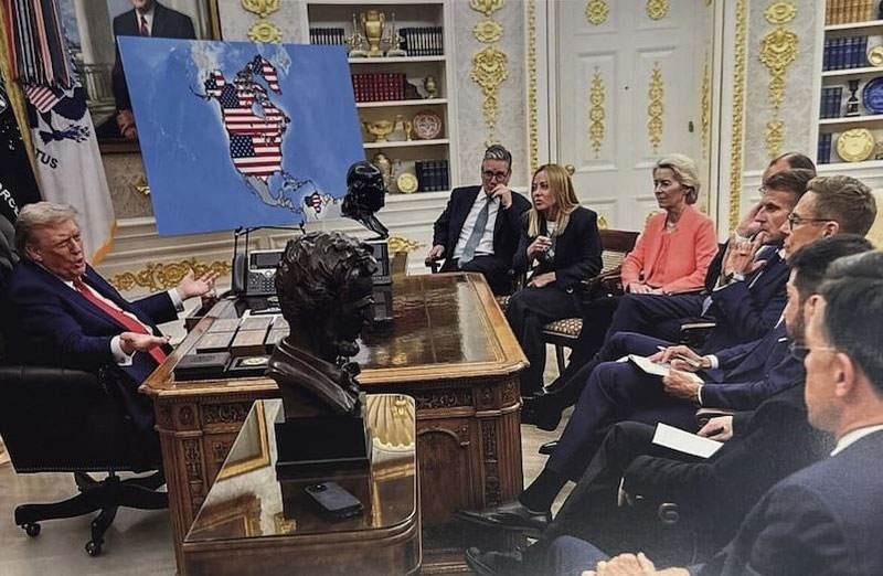
US President Donald Trump shared an image of an altered map on his Truth Social network, depicting Canada, Greenland, and Venezuela as territories marked with the United States national flag. This image has attracted the attention of the global community and is sparking discussions in the sphere of international relations. Zamon.uz reports on this here.
The map was created with the help of artificial intelligence and portrays the northern and southern neighboring regions of the USA as US territory. According to it, Canada, Greenland (an autonomous territory within Denmark), and Venezuela in South America appear as if they are part of America.
Furthermore, among Trump's posts, images placing the US flag on Greenland's territory have also been featured. This does not signify any official status or legal changes regarding it, but rather indicates his attempt to symbolically express his political interest in these territories.
These official posts projectively express Trump's long-standing strategic interest in Greenland, which he has previously considered important from the standpoint of US interests, despite it being an autonomous territory of Denmark. His previous remarks concerning Canada also once again demonstrate his political attention to these regions.